

Descartes Labs is a platform that turns geospatial data into actionable insights about the physical world. The company’s solution can monitor and verify land use to power sustainable sourcing, deforestation, regenerative agriculture, and other net zero use cases.
Images are powerful tools. They tell stories, they document moments, they collect data. There are roughly 6,000 satellites in space, some of which are collecting valuable images of the earth below. These geospatial images, combined with sensor and other data, are now being used to tell the story of what’s happening on earth and the impact of climate change.
Descartes Labs ingests and analyzes geospatial data at scale to produce key insights that are used by businesses. What is geospatial data? It is time-based data that is related to a specific location on the Earth’s surface. It can be as simple as an address, city, or zip code. It can be as complex as geospatial satellite imagery, sensor data, or GPS information. Geospatial data is important because it can provide powerful insights into relationships, patterns, and trends.
The Descartes Labs’ software-as-a-service platform works with a variety of different data sets and makes them available for further analysis and derived insights for their customers. The platform includes both raw and clean data including the datasets in the picture below. SAR data, which stands for synthetic aperture radar, is particularly powerful because it can see in all weather conditions, including cloudy and rainy conditions, to show change over time.
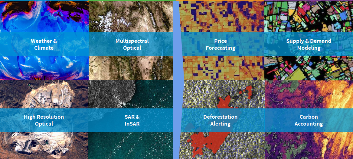
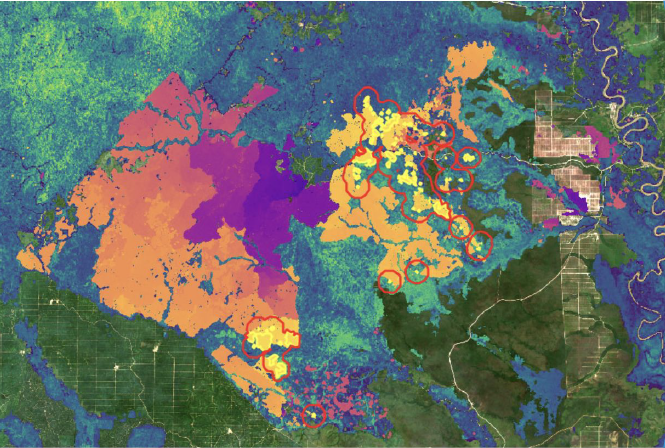
The company uses all this data to produce supply chain analytics used by customers for things like price forecasting and supply and demand modeling - all of which can be used to drive operational cost savings. From a sustainability perspective, this data is also used by their clients to inform sustainable sourcing practices and help companies achieve net zero carbon emission goals. For example, the platform provides deforestation alerts that can highlight where deforestation is accelerating and track tree loss in the form of forest carbon accounting. The platform also monitors regenerative agriculture practices to ensure that companies are adhering to their sustainability commitments.
Overall, geospatial analytics can be useful tools in optimizing business and sustainability practices. They not only help you enhance existing practices, but they also can be critical for setting practical goals based on granular data. Companies of all sizes across multiple industries have an opportunity to apply these datasets to new use cases as they strive to become sustainable organizations.
Additional FREE resources (requires simple email sign-up):
Learn more about Descartes Labs and how it turns geospatial data into actionable insights by watching the company's presentation at our May 2021 ‘Startups Driving Sustainability’ Showcase recording.


Join the conversation.